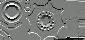
I have come across this image that's labelled a bump map to be used with a 3D model. It looks like this:
In this map, which is an RGB map, it seems we have pixels whose normals face upwards shaded lighter, and normals pointing downward shaded darker. I have isolated just one part of this map, a little mound with a whole in the middle:
I've tried to recreate this shape in an image editing program just using white colour for height, it's essentially a heightmap, or bumpmap. It looks like this:
It's basically a circular mound that rises gradually, and then falls off steeply into a hole.
So I know that this is one way normals and height can be stored. This is essentially a heightmap, but some people and programs call this a bumpmap. In 3DS Max the bumpmap essentially expects a heightmap.
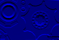
Then there's the normal map, which looks like this:
Inside the red channel the information about how flat or inclined the surface is from left to right:
And same as in the green, except from up to down:
So I understand this, I think. However in the original image, this strange "bumpmap", it only seems to contain the information of the flatness of the surface from up to down, not left to right. What I've shown is how it appears as an RGB image. Here is each of the channels:
They all contain the same information, that is, facing of the surface from up to down.
How is this map supposed work? I've come across a few maps like these but I don't see how they're supposed to work. Can someone explain if this is possible?


